Historial Oil Sands Mine Active Land Tracking...
Dataset description:
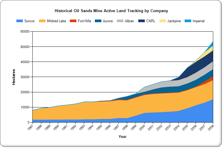
This graph indicates land actively used for oil sands mine operations from 1987 to 2008. By subtracting the amount of land reclaimed (including temporarily reclaimed land and land in...
Source: Historical Oil Sands Mine Active Land Tracking by Company, 1987-2008
追加情報
| フィールド | 値 |
|---|---|
| 最終更新日 | 2025年12月9日 |
| メタデータ最終更新日時 | 2025年12月9日 |
| 作成日 | 2025年12月9日 |
| データ形式 | PNG |
| ライセンス | License not specified |
| Datastore active | False |
| Has views | True |
| Id | 974ed17b-2e74-43fc-9ae2-19e8020a05fe |
| Mimetype | image/png |
| Package id | d9f6e6ec-a3f4-407f-b348-f73d7fab810e |
| Position | 0 |
| Size | 23.4 KiB |
| State | active |
| Url type | upload |